I didn’t sleep a lot, thinking about the Crossing today. So I was awake even before the alarm went off at 3am. I was already mostly packed for a quick getaway, and was on the road at 3:30am.
I was very nervous about today. The TA route takes walkers from north to south, against the normal crossing direction. However this direction adds an extra 350m of vertical elevation to the route, meaning I’ll be going up vertically over 1km before then coming down another 700m on the other side. With a heavy pack too, I was worried how my fitness would cope. And on top of that, doing it while the route was closed due to hazardous weather - the big risk today was gale force winds on the top ridge, along with bad visibility.
The first 7km was a walk along the road to the Ketetahi car park, which marks the beginning of the Tongariro Crossing. I kept humming Lady Writer by Dire Straits as I walked along in the pitch dark (only because it was playing in the holiday park loos at 3am in the morning before I left, and just wouldn’t go away). The wind was already gusting, buffeting me as I walked.
I was at the start of the crossing at 5:25, still in the dark. Deep breath - here we go!
 |
| I knew this. But, it still sounds ominous… |
The first few kilometres were on a bush track, treading carefully in the dark until the sunrise approached. The track followed a mountain stream with a detour to the Ketetahi Falls. The water was almost silvery and glowing eerily in the dark (due to the minerals apparently - it’s totally undrinkable).
 |
| Attempting to take a pic of the Ketetahi Falls in the dark. Spooky! |
 |
| That’s nice… |
Then the steps started - more and more of them. I was feeling quite exhausted already - maybe due to my early start, lack of sleep and long day yesterday.
 |
| Time for a break and an OSM bar already. I’m going to need the energy. |
 |
| And more steps! |
Eventually I emerged from the bush cover. It was cloudy, no sign of rain, but definitely very windy. The trail continued through alpine scrub, occasionally over streams and rocks, but always winding steadily upwards around the mountain.
 |
| The signs are all for hikers crossing south to north. This one showed me I had a long way to go! |
 |
| Ni views of the top of the mountain, it was obscured by cloud |
 |
| But lovely views to the east, of Lake Rotoaira and behind that Lake Taupo |
 |
| Passing a steaming vent |
 |
| Crossing small streams of silvery water |
 |
| Heading steadily uphill |
 |
| Looking down the mountain over alpine grasses |
The higher the trail went, the stronger the wind became. The trail headed steadily to the cloud layer that obscured the top of the mountain. Eventually I reached it - and there the views stopped.
 |
| Another break, at the edge of the cloud layer. |
Once under the cloud, conditions changed. The wind continued to increase, blasting drizzle horizontally at me. I stopped to put on my wet weather gear and gloves - though my gloves weren’t designed for these conditions, and my hands were freezing in the wind chill.
 |
| All geared up |
 |
| Continuing on |
The path became rougher, windier, wetter and rockier the more I climbed. I had my head down, pushing on. I seemed to have enough energy now - I think it was a sense of urgency, I just wanted to get through this, before conditions got even worse. There was no view, just trudging upwards through the wind and cloud.
 |
| Very little visibility - marker poles were becoming hard to see |
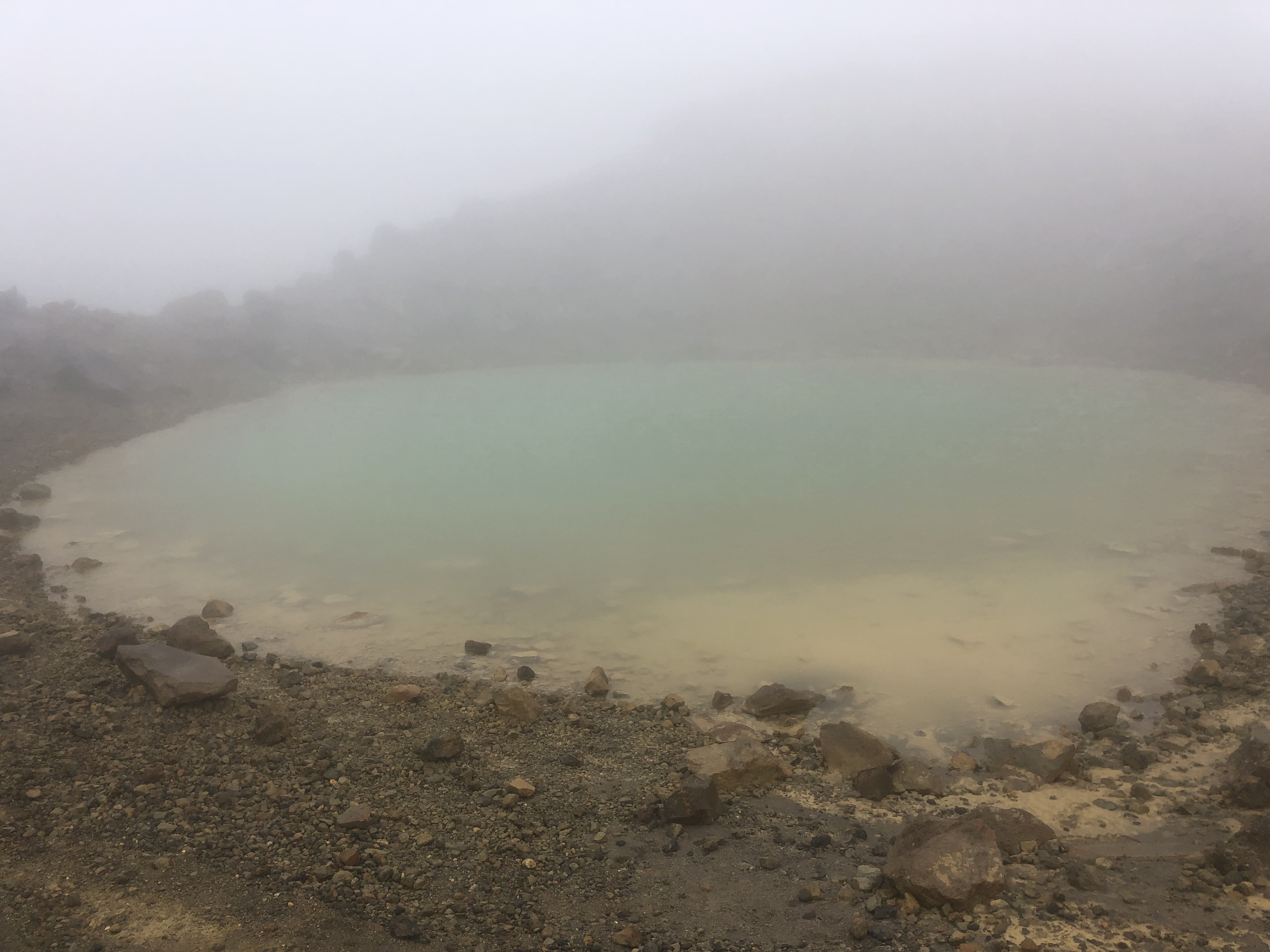
Three of my TA friends caught up with me at this point - they had been dropped off to the starting car park shortly after I arrived there, and had been following me up the mountain. They continued to follow behind me, probably close by but hidden by the cloud. We passed the views of the stunning Blue Lake without realising it (completely hidden in the cloud). The Emerald Lake is tiny, and right next to the trail, which is the only reason I stumbled across it.
 |
| The Emerald Lake |
 |
| 10am pic (possibly - I lost track of time!) |
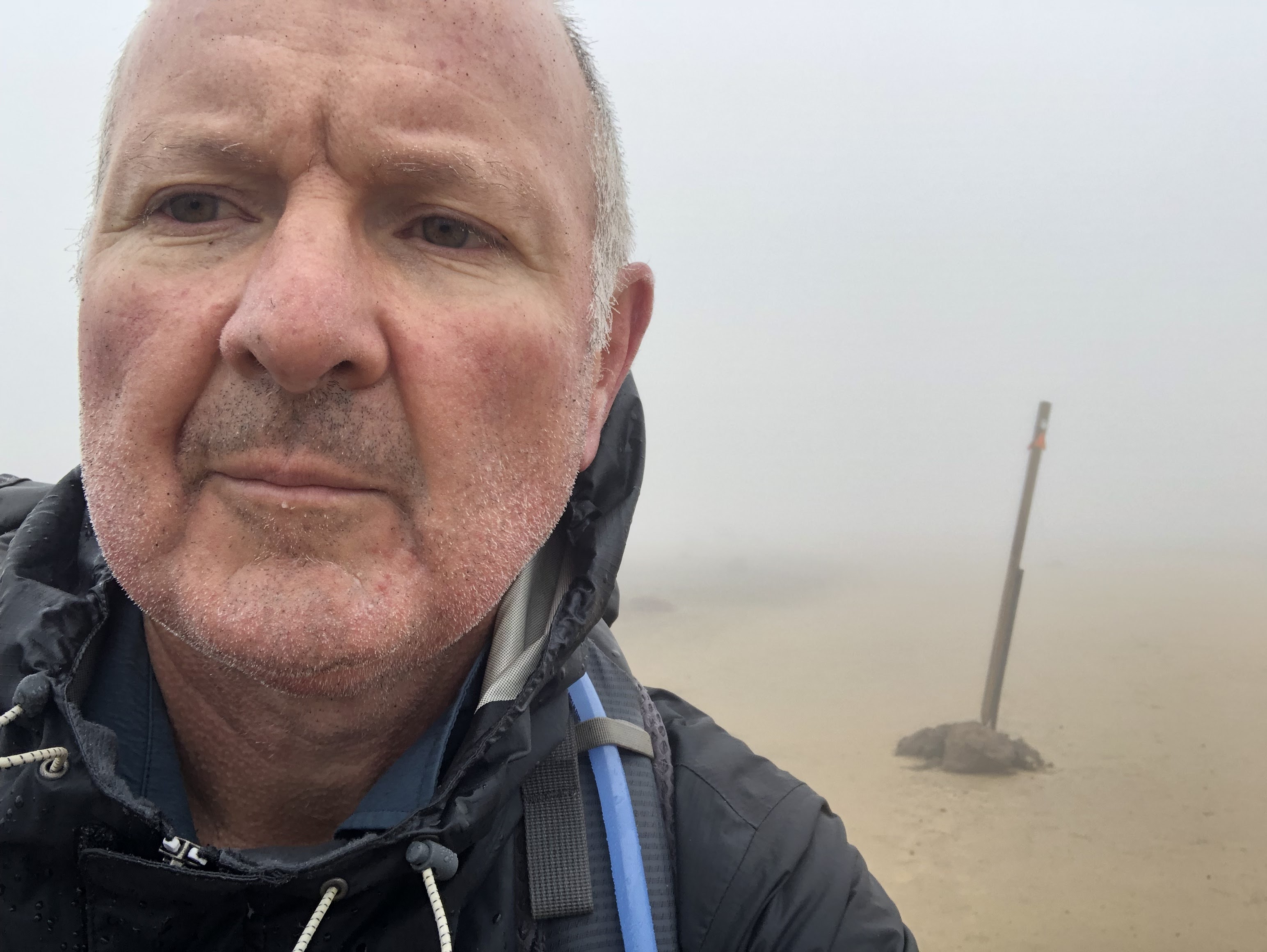
It was incredibly hard to take photos - with the wind, rain, my gloves getting in the way. I was now about to tackle the hardest part of the trail - heading up the scree slope to the ridge of the Red Crater, the highest point on the crossing. The winds were clearly gale strength now - the gusts were catching my pack and almost blowing me over as I inched slowly up the slope, so I was having to stop and brace myself continually. And the marker poles were hidden in the cloud, so I had navigate by guesswork until I saw each new one ahead in the mist.
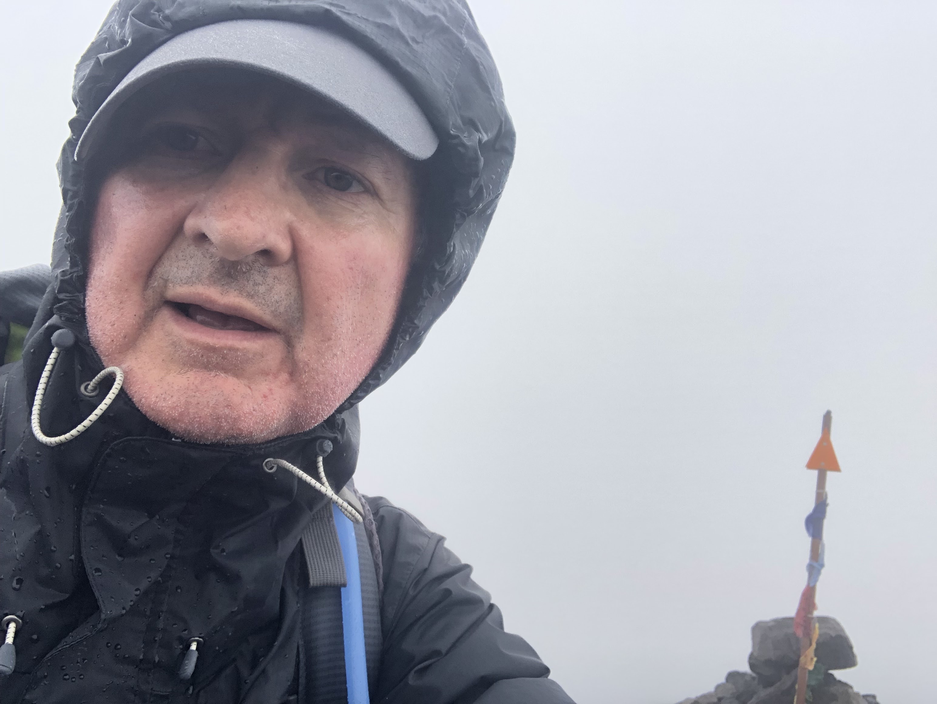
Finally I reached the ridge at the top. I had to wait for a lull in the gusts before rushing across to the cairn of stones that I assumed marked the highest point.
 |
| I made it! (I think?) |
 |
| The view from the top… |
The problem was - where to go now? I couldn’t see any other poles as I continued along the ridge. Which continued to get even narrower. And narrower. And the wind even stronger, until it was singing loudly in my ears. I had to drop to my knees and crawl, and then shuffle on my bum. But finally I couldn’t go any further. The narrowing ridge ahead seemed completely impassable. The wind was roaring so strongly I couldn’t even stand. I sat there for 5 minutes, facing up to the fact that I had to turn back down the mountain. After getting so far, I was not going to be crossing Tongariro today after all.
However turning around was not easy - in fact, it was the scariest thing I did on the mountain today. The wind was threatening to rip off my hat and poles. I managed after several more minutes to somehow get from a sitting position to my hands and knees, and then proceeded to crawl slowly back up the ridge. Eventually I reached the cairn of stones from before.
Finally able to stand, I was about to head back down the scree slope he way I had come - when the clouds thinned briefly, and I saw a glimpse of a new marker pole. I’d gone off the path - the real trail headed down behind the cairn of stones, and I’d missed it in the cloud on the way up. There was still a chance I’d get over this bloody mountain today!
The new route was back down another slope with scree and large rocks. The wind was still blowing me around strongly and the visibility was no better, and it was 30 minutes more before I started to feel safe. I was wet, cold, and rather shaken; I didn’t even try to take photos, I was just trying to forge on down the mountain as fast as possible.
Finally, a sign:
 |
| Why didn’t they have this on the OTHER side?! |
The trail for a while passed through what feel like a moonscape - an eerie, misty, flat plain of soft dust and sand.
 |
| Very spooky! |
The landscape continued to become more barren and volcanic, full of sharp black rocks and the signs of past eruptions, until it eventually emerged back below the cloud layer.
 |
| A couple more hardy hikers in the distance |
 |
| Very harsh volcanic landscapes on the way down |
 |
| The loos are camouflaged to look like rocks! |
 |
| Heading steadily down |
On the way down I passed several day hikers, coming up the crossing from the opposite direction, wanting to try their luck getting over the mountain. On a sunny day there would probably be a thousand people crossing, today I saw less than 20 on the mountain.
 |
| A brief detour to the Soda Springs |
 |
| Back to alpine grasses |
 |
| And even boardwalk! |
 |
| NOW they tell me! |
And eventually, my destination: Mangatepopo Hut. This is a DOC hut - I had made a last-minute booking at the campsite here, but I was really hoping there would be a spare bed inside.
 |
| Mangatepopo Hut |
I got there to find several of my TA friends already there - the ones who I had seen on the mountain, plus several more who must have been close behind them, all of who must have passed me while I was stuck on the ridge. The hut was very busy and noisy, mostly with hikers stuck there unable to do the crossing. But there was indeed a spare mattress - and the weather was closing in even here, so I had no hesitation grabbing it. I hung up my wet clothes by the fire, then it was straight into my sleeping bag to recover. I emerged only to eat some noodles and tuna, and then it was back to sleep.
 |
| Fellow TA-ers Nic and Ally, from Queenstown. |
Well, what a day! This was the big one, and I made it - none of the incredible views I had imagined, but certainly an adventure to tell! In hindsight, it definitely wasn’t a sensible decision to cross today - but I’m here on the other side now, and able to continue with my TA. What a relief!
 |
| Today’s route |


Great photos, Simon, and worth the wait. Lovely to talk to you. We are both in awe of the conditions you had to contend with and your decision to go ahead with the crossing in the first place. Atrocious weather here and forcast for the next week. Some challenging kayaking conditions coming up for you from the sound of it, too. Take care and stay safe. XX..
ReplyDeleteThanks Mum! I’m about to tuck into some ribs at the local bar right now, then will work on my blog updates. Taking it very easy for a couple of days! xx
Delete